The Korean War
June 25, 1950
An invasion of 100,000 North Korean troops across the 38th parallel starts the Korean War, forcing South Korean forces into an organized retreat.
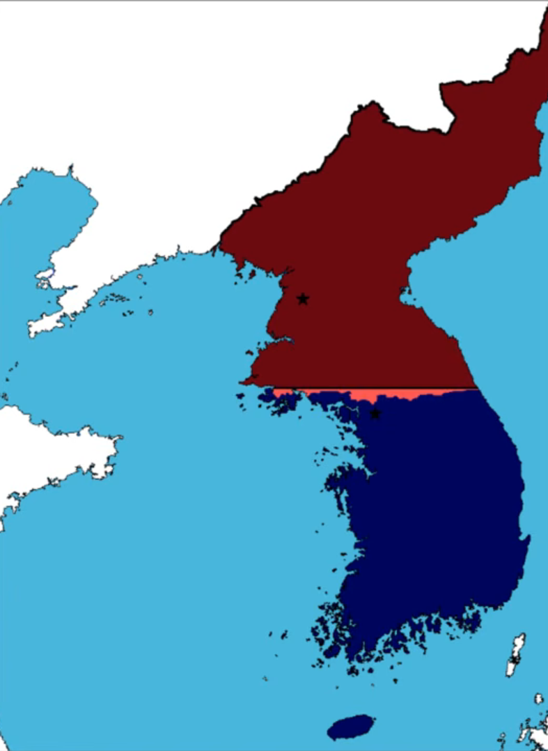
Fig. 1. A map of Korea showing South Korean forces in dark blue, South Korean occupations in blue, South Korean gains in light blue, North Korean forces in maroon, North Korean occupations in burgundy, and North Korean gains in pink; screenshot from EmperorTigerstar, "The Korean War: Every Day," YouTube, 0:04.
June 27, 1950
The UN Security Council passes Resolution 83 to aid South Korea.
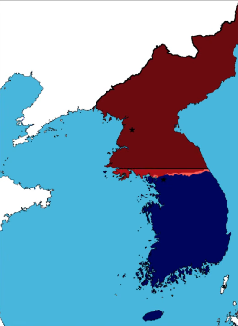
Fig. 2. A map of Korea showing South Korean and UN forces in dark blue, South Korean and UN occupations in blue, South Korean and UN gains in light blue, North Korean forces in maroon, North Korean occupations in burgundy, and North Korean gains in pink; screenshot from EmperorTigerstar, "The Korean War: Every Day," YouTube, 0:04.
June 28, 1950
North Korean forces capture Seoul, the South Korean capital.
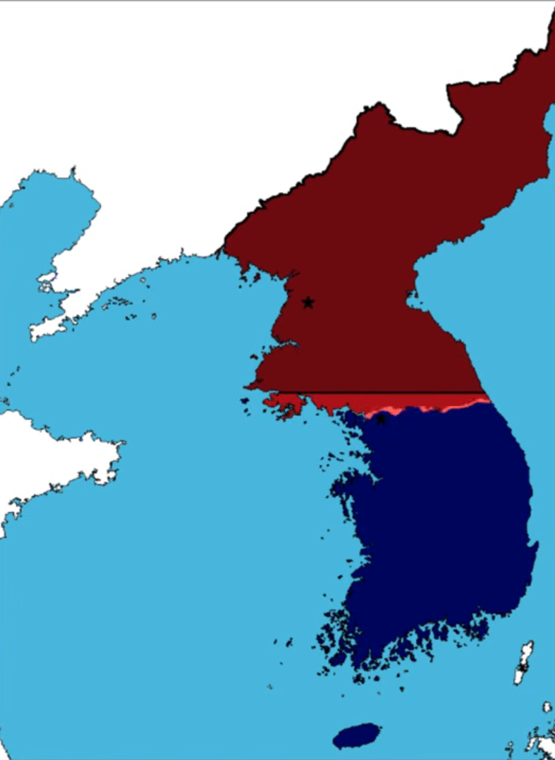
Fig. 3. A map of Korea showing South Korean and UN forces in dark blue, South Korean and UN occupations in blue, South Korean and UN gains in light blue, North Korean forces in maroon, North Korean occupations in burgundy, and North Korean gains in pink; screenshot from EmperorTigerstar, "The Korean War: Every Day," YouTube, 0:04.
September 12, 1950
North Korean troops reach the Pusan Perimeter, pushing UN troops to a 5,000-square-mile corner of southeastern Korea around the port city of Pusan.
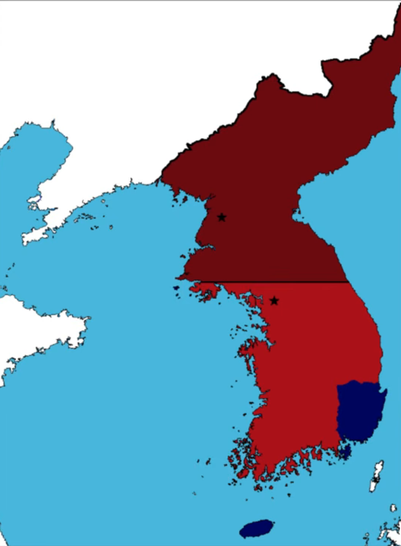
Fig. 4. A map of Korea showing South Korean and UN forces in dark blue, South Korean and UN occupations in blue, South Korean and UN gains in light blue, North Korean forces in maroon, North Korean occupations in burgundy, and North Korean gains in pink; screenshot from EmperorTigerstar, "The Korean War: Every Day," YouTube, 0:19.
September 15, 1950
U.S. Major General Edward M. Almond leads X Corps in a daring amphibious landing at Inch’ŏn, 150 miles behind enemy lines. This brilliant plan by UN commander General Douglas MacArthur succeeds completely.
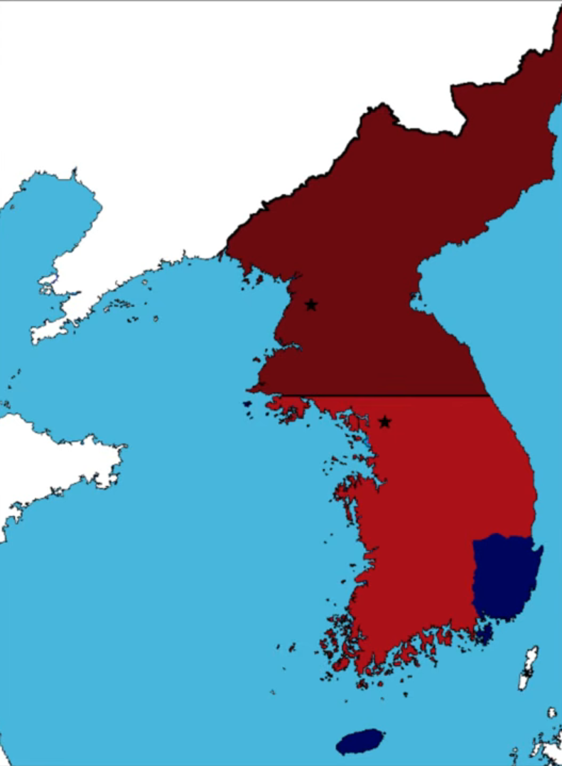
Fig. 5. A map of Korea showing South Korean and UN forces in dark blue, South Korean and UN occupations in blue, South Korean and UN gains in light blue, North Korean forces in maroon, North Korean occupations in burgundy, and North Korean gains in pink; screenshot from EmperorTigerstar, "The Korean War: Every Day," YouTube, 0:20.
September 25, 1950
South Korean and UN forces liberate Seoul.
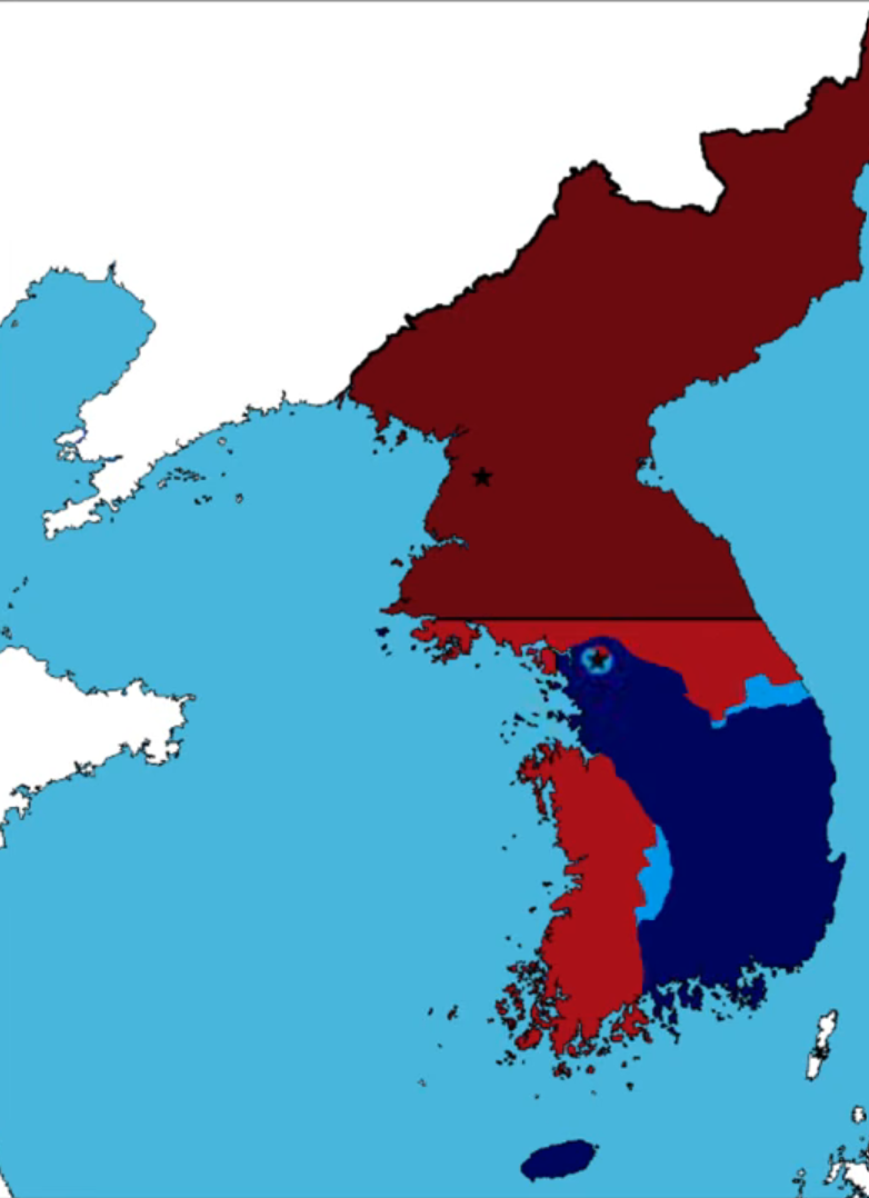
Fig. 6. A map of Korea showing South Korean and UN forces in dark blue, South Korean and UN occupations in blue, South Korean and UN gains in light blue, North Korean forces in maroon, North Korean occupations in burgundy, and North Korean gains in pink; screenshot from EmperorTigerstar, "The Korean War: Every Day," YouTube, 0:22.
October 19, 1950
South Korean and UN forces capture Pyongyang, the North Korean capital.
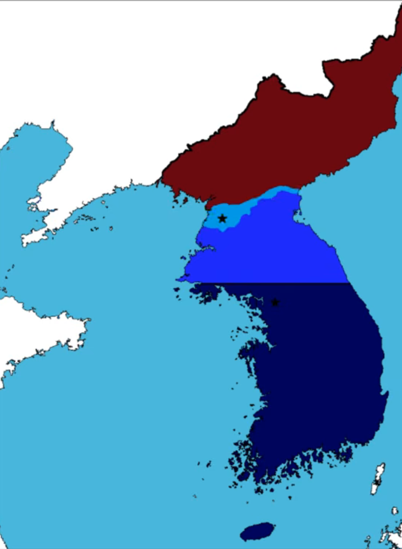
Fig. 7. A map of Korea showing South Korean and UN forces in dark blue, South Korean and UN occupations in blue, South Korean and UN gains in light blue, North Korean forces in maroon, North Korean occupations in burgundy, and North Korean gains in pink; screenshot from EmperorTigerstar, "The Korean War: Every Day," YouTube, 0:27.
October 25, 1950
UN troops advance to the Yalu River after destroying the North Korean army. Chinese forces under General Peng Dehuai cross the border and inflict heavy losses on UN troops to force them back to the Ch’ŏngch’ŏn River.
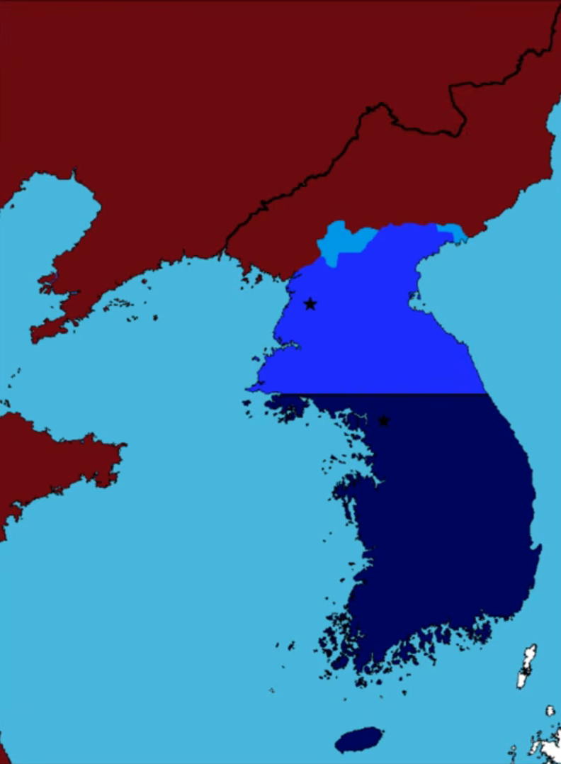
Fig. 8. A map of Korea showing South Korean and UN forces in dark blue, South Korean and UN occupations in blue, South Korean and UN gains in light blue, North Korean and Chinese forces in maroon, North Korean and Chinese occupations in burgundy, and North Korean and Chinese gains in pink; screenshot from EmperorTigerstar, "The Korean War: Every Day," YouTube, 0:28.
December 5, 1950
North Korean and Chinese forces liberate Pyongyang.
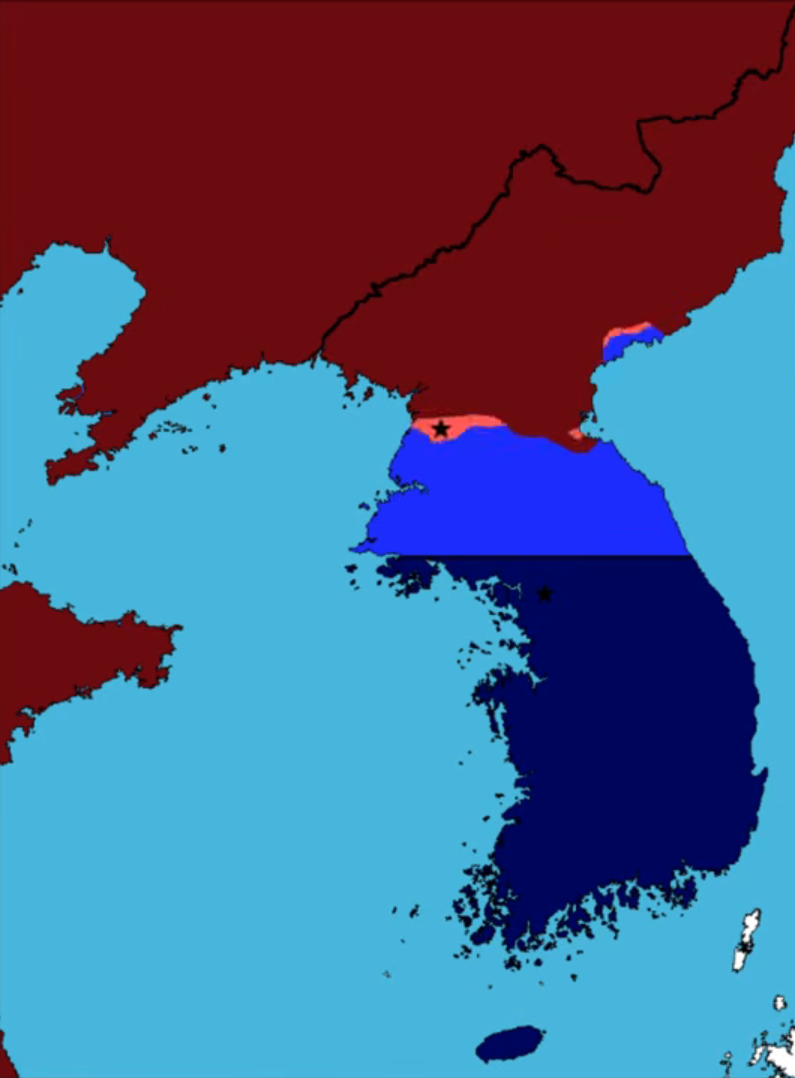
Fig. 9. A map of Korea showing South Korean and UN forces in dark blue, South Korean and UN occupations in blue, South Korean and UN gains in light blue, North Korean and Chinese forces in maroon, North Korean and Chinese occupations in burgundy, and North Korean and Chinese gains in pink; screenshot from EmperorTigerstar, "The Korean War: Every Day," YouTube, 0:36.
December 6, 1950
The 1st Marine Division begins a brutal fighting retreat from the Chosin Reservoir to Hŭngnam. Though forced from North Korea, the Marines inflict up to 80,000 casualties, crippling the Chinese Ninth Army Group and cementing the "Frozen Chosin" in Marine Corps legend.
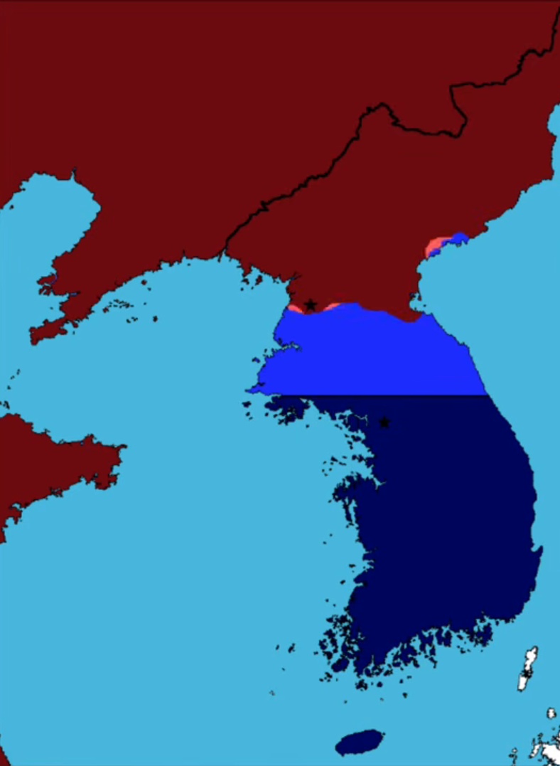
Fig. 10. A map of Korea showing South Korean and UN forces in dark blue, South Korean and UN occupations in blue, South Korean and UN gains in light blue, North Korean and Chinese forces in maroon, North Korean and Chinese occupations in burgundy, and North Korean and Chinese gains in pink; screenshot from EmperorTigerstar, "The Korean War: Every Day," YouTube, 0:36.
January 4, 1951
North Korean and Chinese troops recapture Seoul.
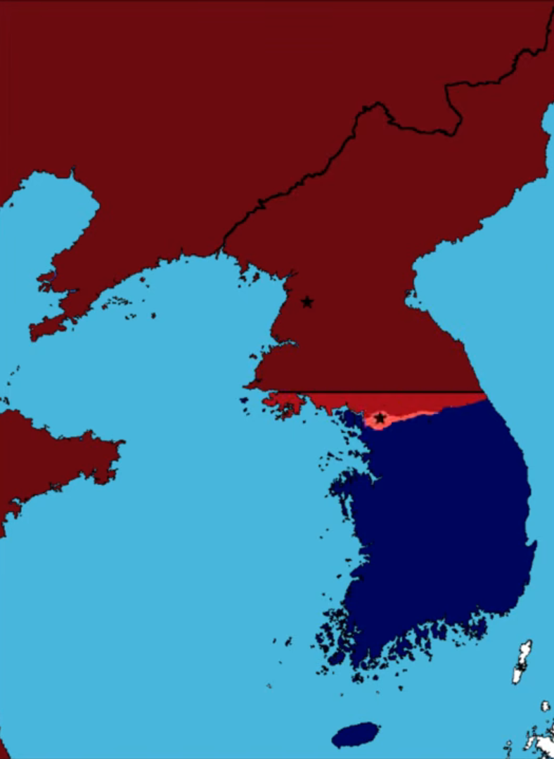
Fig. 11. A map of Korea showing South Korean and UN forces in dark blue, South Korean and UN occupations in blue, South Korean and UN gains in light blue, North Korean and Chinese forces in maroon, North Korean and Chinese occupations in burgundy, and North Korean and Chinese gains in pink; screenshot from EmperorTigerstar, "The Korean War: Every Day," YouTube, 0:42.
March 14, 1951
South Korean and UN forces once again liberate Seoul.
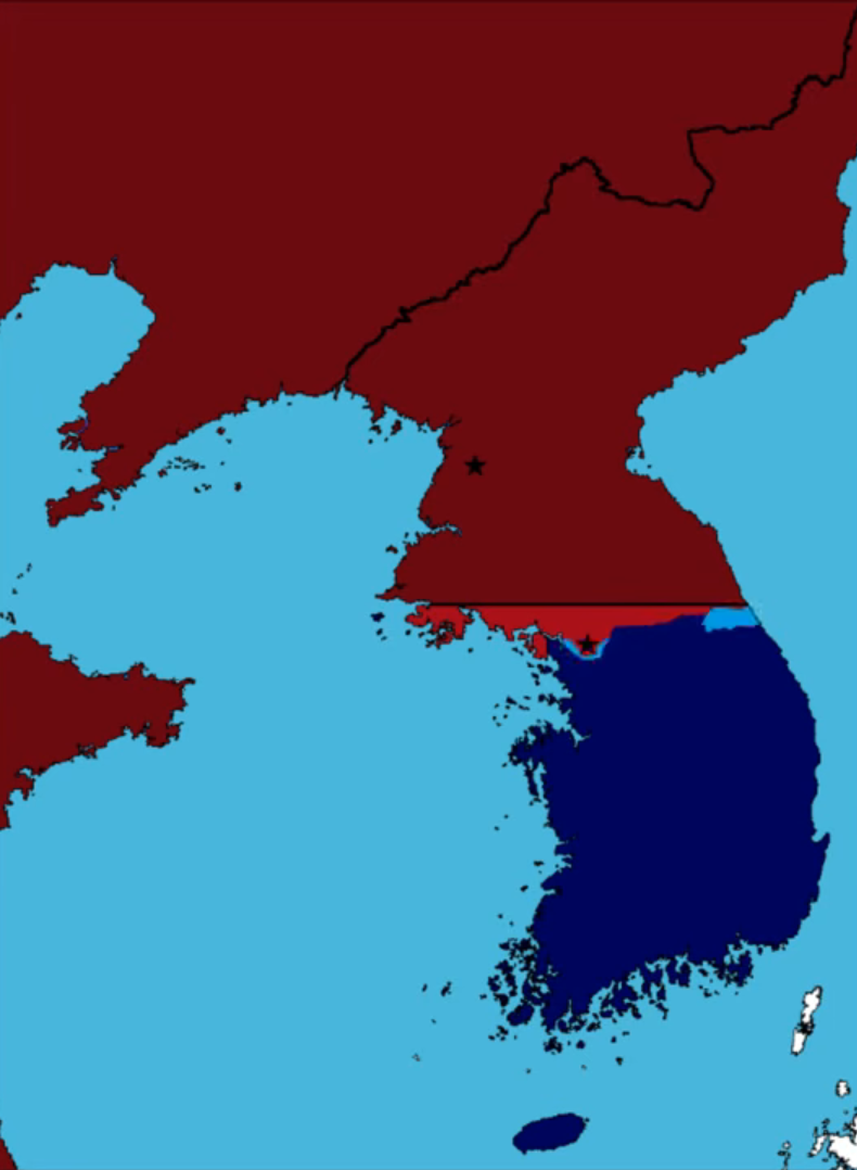
Fig. 12. A map of Korea showing South Korean and UN forces in dark blue, South Korean and UN occupations in blue, South Korean and UN gains in light blue, North Korean and Chinese forces in maroon, North Korean and Chinese occupations in burgundy, and North Korean and Chinese gains in pink; screenshot from EmperorTigerstar, "The Korean War: Every Day," YouTube, 0:56.
April 11, 1951
President Harry S. Truman relieves General Douglas MacArthur of his military commands due to insubordination and public disagreement over the Korean War's limited scope. Lieutenant General Matthew Ridgway succeeds MacArthur as the leader of United Nations forces.
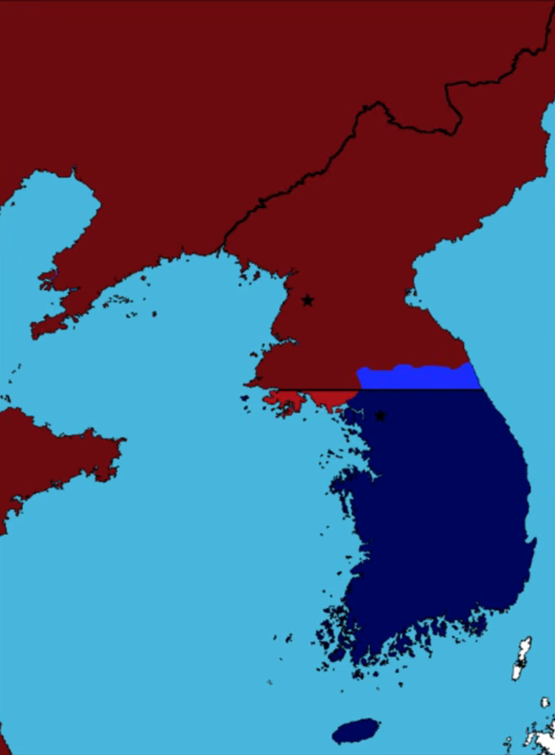
Fig. 13. A map of Korea showing South Korean and UN forces in dark blue, South Korean and UN occupations in blue, South Korean and UN gains in light blue, North Korean and Chinese forces in maroon, North Korean and Chinese occupations in burgundy, and North Korean and Chinese gains in pink; screenshot from EmperorTigerstar, "The Korean War: Every Day," YouTube, 1:02.
July 10, 1951
Open truce talks between the UN and communist forces begin at Kaesŏng, though heavy combat rages on for two more years. Negotiations later shift to P’anmunjŏm in October.
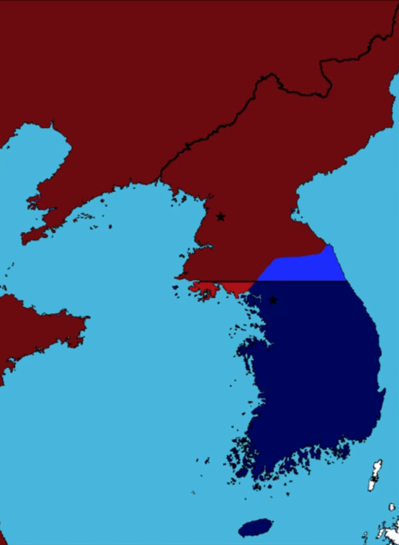
Fig. 14. A map of Korea showing South Korean and UN forces in dark blue, South Korean and UN occupations in blue, South Korean and UN gains in light blue, North Korean and Chinese forces in maroon, North Korean and Chinese occupations in burgundy, and North Korean and Chinese gains in pink; screenshot from EmperorTigerstar, "The Korean War: Every Day," YouTube, 1:15.
July 27, 1953
Mark W. Clark, Peng Dehuai, and Kim Il-Sung sign the Korean Armistice Agreement on July 27, 1953, halting three years of conflict and establishing the Korean Demilitarized Zone (DMZ) that roughly follows the Military Demarcation Line (MDL), the exact land border between North Korea and South Korea.
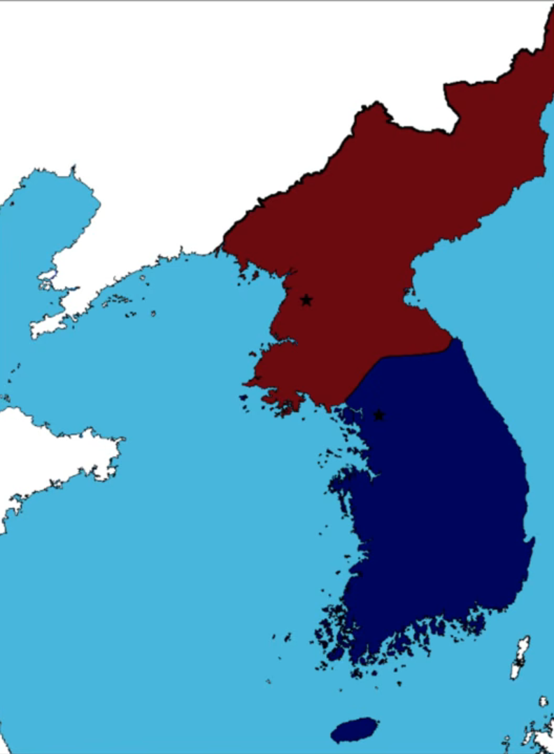
Fig. 15. A map of Korea showing South Korea in dark blue and North Korea in maroon; screenshot from EmperorTigerstar, "The Korean War: Every Day," YouTube, 1:20.
Bibliography
Ray, Michael. "Korean War Timeline." Encyclopedia Britannica. June 13, 2025. https://www.britannica.com/list/korean-war-timeline.